
Hiking Near Tokyo 2026–27: Trails, Parks, Kayaking and Camping in Japan
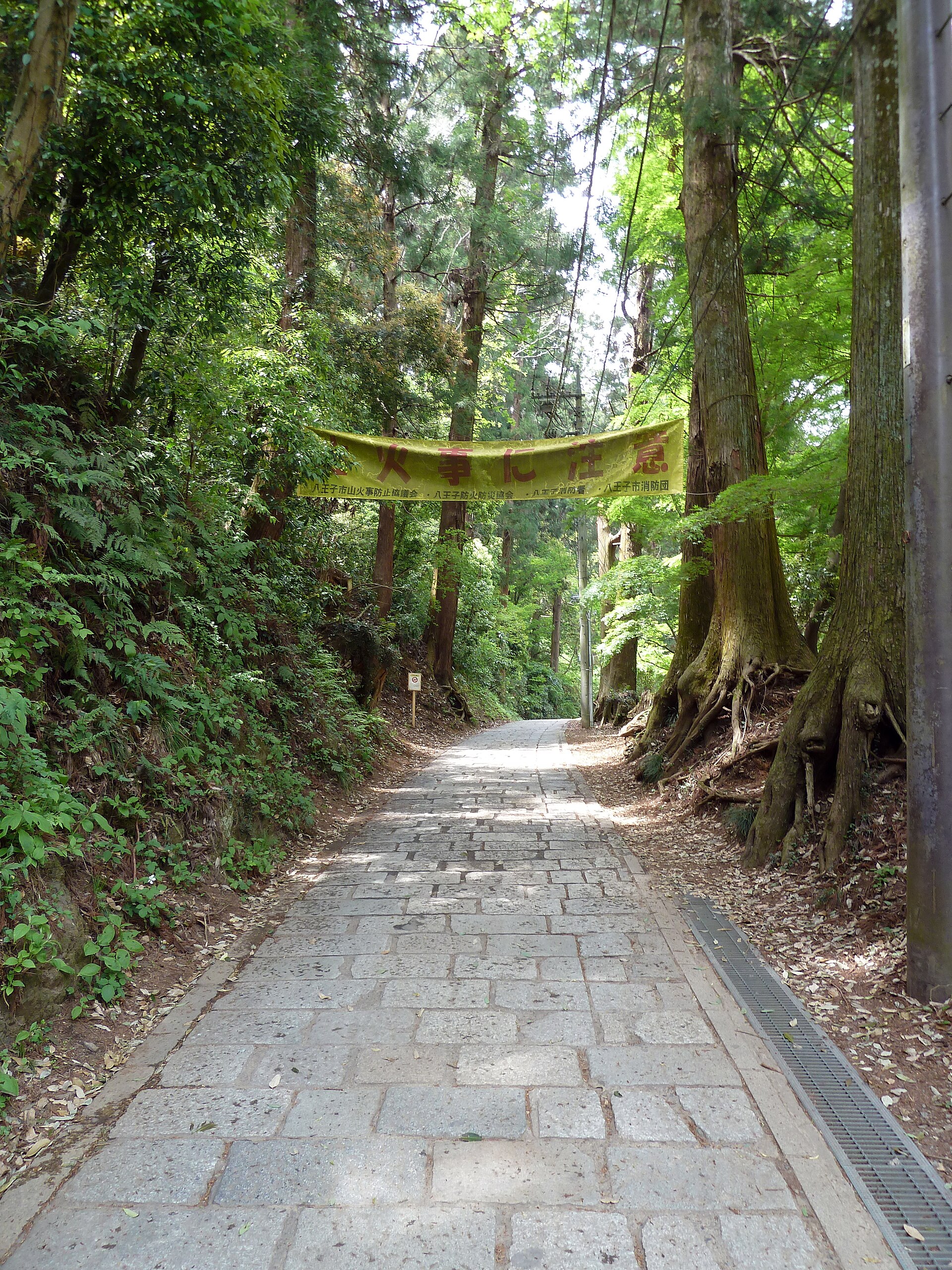
The best hiking near Tokyo is on Mt Takao and Mt Mitake: both are around an hour or two from Shinjuku by train, have cable cars, and work in trainers on a dry day. For a bigger trip, Kamikochi in the Japan Alps is open until 15 November 2026, and the Kumano Kodo, the Nakasendo and Yakushima give you proper multi-day walking.
This hub covers trails, parks, kayaking and campsites, with access, prices and season dates for 2026–27, plus the bear advice Japan’s Ministry of the Environment and the Tokyo government now give hikers. Everything was checked between 19 and 21 October 2026.
¥490
Mt Takao cable car, one way
15 Nov 2026
Kamikochi closing ceremony
68
People hurt by bears in Japan, Apr–Sep 2026 (provisional)
¥700
Mt Mitake cable car, one way, from 1 Oct 2026
Where is the best hiking near Tokyo?
Pick by the time you have. For hiking near Tokyo on a half day, choose Takao, Mitake or the Kamakura trails.
Hakone works as a day or an overnight. The rest need a night or more.
| Place | Come arrivare | Walking time | Best months (2026–27) | Level |
|---|---|---|---|---|
| Mt Takao | Keio Line, Shinjuku to Takaosanguchi, about 50 min | 1.5–4 hours | Leaves mid-Nov to early Dec; spring | Easy |
| Mt Mitake | JR to Mitake, bus about 10 min, cable car 6 min | About 3.5 hours (Rock Garden loop) | Autumn, spring, early summer | Easy to moderate |
| Kamakura trails | JR Yokosuka Line to Kita-Kamakura | About 1–2.5 hours | Year-round outside heavy rain | Easy |
| Hakone | Odakyu Romancecar to Hakone-Yumoto | 2–4 hours per trail | Spring and autumn | Easy to moderate |
| Kamikochi | Matsumoto or Takayama, then bus | Flat valley walks, 1–6 hours | Until 15 Nov 2026; reopens spring 2027 | Easy (valley) |
| Kumano Kodo (Nakahechi) | Shin-Osaka to Kii-Tanabe, bus to Takijiri | About 38 km over 3 days | Late Mar to early Apr; Oct to Nov | Moderate to hard |
| Nakasendo (Magome–Tsumago) | Nakatsugawa or Nagiso, then bus | About 8 km, 2–3 hours | Spring to autumn | Easy |
| Yakushima (Jomon Sugi) | Fly or ferry from Kagoshima | About 10 hours return | Mar–Nov (shuttle season) | Hard |
Times come from the operators and tourist bodies linked in each section. If you only want an easy day out by train, our day trips from Tokyo by train guide covers Takao, Hakone and Nikko as sightseeing trips. This page is about the trails.
Which Mt Takao trail should you take?
Takao has eight marked routes, and the right one depends on crowds, not fitness. The Keio Line runs from Shinjuku to Takaosanguchi in about 50 minutes by express for ¥390, according to the Mt Takao Magazine access page. Keio also sells a round-trip ticket bundled with the cable car or chairlift at 20% off; buy it at any Keio station except Takaosanguchi.
| Trail | Length | Why take it |
|---|---|---|
| 1 (Omotesando) | 3.8 km | The main route past Yakuo-in temple, with 5 toilets; busiest |
| 6 (Biwataki) | 3.3 km | Shaded stream path, quieter going up |
| Inariyama (Mitsuharashi Ridge) | 3.1 km | Ridge walk with views; good for descending |
| 4 (Suspension Bridge) | 1.5 km | Short link with the suspension bridge |
| Takao–Jinba traverse | 15.3 km | A full-day ridge walk for fit hikers |
Trail lengths are from the Takao Tozan course page. The cable car and chairlift each cost ¥490 one way or ¥980 return for adults (¥250 / ¥500 for children aged 6–11), per the official fares page.
The cable car runs from 8:00, with the last car at 17:45 on weekdays and 18:00 at weekends in September to November, and 17:15 / 17:30 in December. Since September 2026 you can tap a transit IC card at the gate.
Il Takao Momiji Festival runs from 24 October to 13 December 2026, and the organisers say the leaves usually peak from mid-November to early December. The cable car is lit up from sunset to 20:30 on Fridays, weekends and holidays from 1 November to 6 December.
Go on a weekday morning, or take Trail 6 up and Inariyama down to dodge the queues. For Tokyo’s other leaf spots, see Tokyo autumn leaves 2026.
Is Mt Mitake better than Takao for hiking near Tokyo?
For a quieter day, yes. Take the JR Chuo Line to Ome, change to the Ome Line for Mitake Station, then a bus of about 10 minutes to the cable car (JNTO).
The Mitake Tozan cable car takes about 6 minutes. From 1 October 2026 it costs ¥700 one way or ¥1,400 return for adults; return tickets are valid for two days (Mitake Tozan Railway).
The classic loop is JNTO’s Cable Car and Rock Garden circuit: 7.8 km in about 3.5 hours. It passes Musashi Mitake Shrine at 929 m, Nanayo Falls, Ayahiro Falls and the mossy Rock Garden. Fitter walkers can carry on to Mt Odake or Mt Hinode.
Where can you hike in Hakone?
Hakone is best known for its transport loop, but four trails make it a proper hiking trip. Hakone’s official visitor site lists these (Hakone Japan, updated May 2026):
- Old Tokaido Road: about 7 km from Hakone-Yumoto to Lake Ashi in 2–3 hours, on old stone paving past the Amazake Chaya teahouse.
- Mt Kintoki (1,212 m): 2.5–3.5 hours return from Kintoki Shrine or Otome Pass, with one of the best close-up views of Mt Fuji.
- Mt Komagatake (1,356 m): 2–2.5 hours up from Moto-Hakone or Hakone-en, or about 30 minutes by ropeway.
- Mt Myojogatake (924 m): 3–4 hours return from Gora or Miyagino.
The trail from Owakudani to Mt Kamiyama can close when volcanic gas levels rise. In its August 2026 report, the Japan Meteorological Agency kept Hakone at volcanic alert level 1, the lowest level, while reminding visitors that Hakone is an active volcano. For trains, passes and a ryokan night, use our one-night Hakone itinerary.
Which Kamakura hiking trails are open?
Kamakura is the best hiking near Tokyo if you want temples and the sea on the same day. It has three short ridge trails.
Typhoon damage in September 2019 closed all of them, and the city reopened them in stages from 2020 (Kamakura City trail notices). Check that page before you go, especially after heavy rain.
- Kuzuharaoka–Daibutsu course: about 3 km and 1 hour 10 minutes, from beside Jochi-ji temple (10 minutes from Kita-Kamakura Station) through Genjiyama Park to the Great Buddha at Kotoku-in (Rurubu).
- Tenen course (the Kamakura Alps): about 5–6 km and 2.5 hours, from Kencho-ji (¥500 entry) over Taiheizan, Kamakura’s highest point at about 159 m, down to Zuisen-ji (BE-PAL, Dec 2024). Stay on the official route: the Shishimai shortcut crosses private land.
- Gionyama course: a short climb above the east side of town, also reopened after the typhoon closures.
Kumano Kodo and Nakasendo: which multi-day walk suits you?
Kumano Kodo (Nakahechi route)
The standard walk runs from Takijiri-oji to Kumano Hongu Taisha: about 38 km over three days, with about 2,240 m of climbing in total (Inside Kyoto). The usual stops are Takahara on night one and Nonaka (Tsugizakura-oji) on night two. Take the Kuroshio limited express from Shin-Osaka to Kii-Tanabe (about 2 hours 15 minutes), then the bus to Takijiri (about 40 minutes).
Book rooms early: villages have few beds. The Tanabe City Kumano Tourism Bureau lists two current closures. The Ohechi coastal route between Wabuka and Tako stations is shut for expressway building from 8 June 2026 to about 30 April 2027.
The Kohechi has a landslide detour at Obako Pass. Winter (December to February) can bring snow on the passes.
Nakasendo (Magome to Tsumago)
This is the easy one: about 8 km of old post road in 2–3 hours, with slightly less climbing if you walk from Magome to Tsumago (japan-guide). Direct buses between the two towns are infrequent, so check the timetable before you set off. The tourist offices in both towns run a seasonal luggage-forwarding service from late March to November, so you can walk with a daypack.
How do you hike Yakushima’s Jomon Sugi?
Yakushima is a subtropical island south of Kagoshima with ancient cedar forest. Flights take about 40 minutes from Kagoshima, 55 from Fukuoka and 80 from Osaka Itami; high-speed boats from Kagoshima take 2–3 hours and the ferry 4–4.5 hours (Ministry of the Environment).
The Jomon Sugi cedar is about a 10-hour return hike from the Arakawa trailhead. From March to November private cars can’t use the trailhead road; shuttles run from the Yakusugi Museum, about 40 minutes away (japan-guide, May 2025).
Hikers from junior-high age are asked for a conservation donation of ¥1,000 for a day trip or ¥2,000 if staying overnight in the mountains (Ministry of the Environment). At Arakawa you pay it when you buy your shuttle ticket.
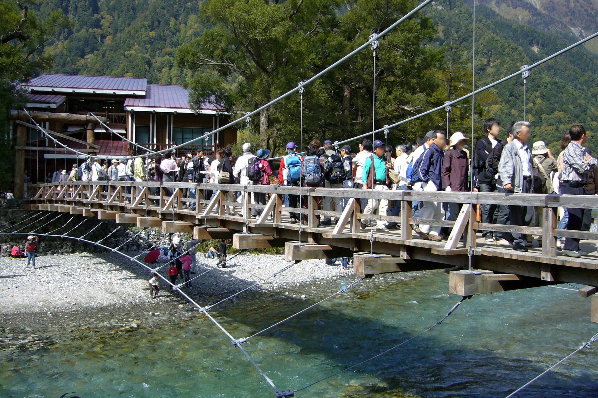
When is Kamikochi open in 2026 and 2027?
Kamikochi’s 2026 season ends with the closing ceremony on 15 November 2026 (Kamikochi Tourism Association). Most hotels take their last guests on the night of 14 November.
Myojinkan closed after 31 October, and Tokusawa Lodge and Kamonjigoya close after 4 November. The association warned bus operators about ice and snow on 17 October, so dress for frost.
Private cars, rental cars and motorbikes are banned past the Kama Tunnel all year (access rules). Park at Sawando (¥800 a day) from the Matsumoto side or Hirayu Akandana (¥600) from Takayama, then take the shuttle bus or a taxi.
Without a car, take the train from Matsumoto to Shin-Shimashima and then the bus (about 1.5 hours), or the bus from Takayama via Hirayu (about 1 hour 25 minutes). Direct buses from Tokyo need a reservation (access page).
No 2027 opening date had been announced by between 19 and 21 October 2026. In 2025 the road was open to buses and taxis from 17 April to 15 November, so plan on a similar mid-April start and check before booking.
Where can you go kayaking in Japan?
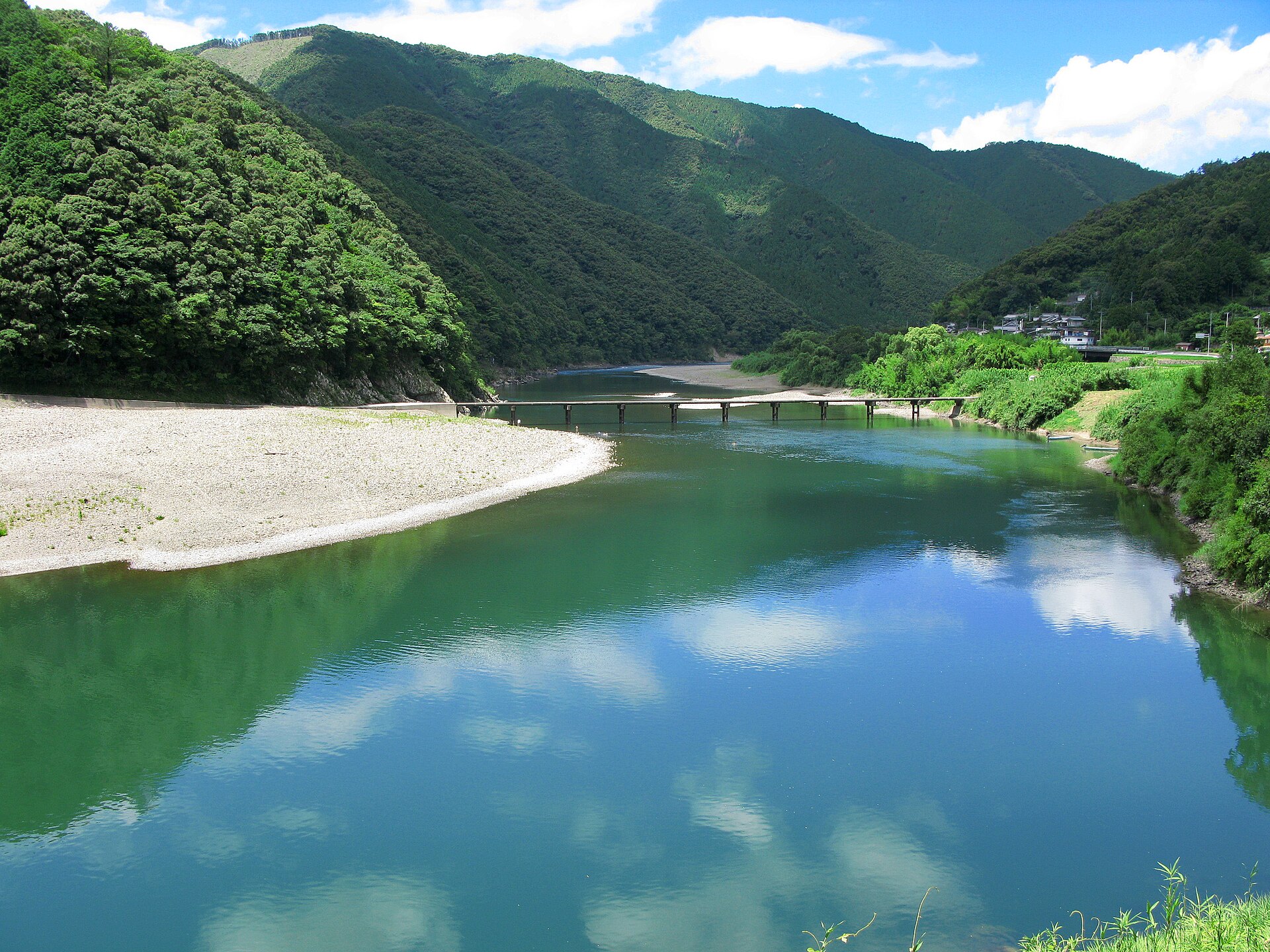
Shimanto River, Kochi
The Shimanto in western Shikoku is Japan’s classic canoe river: no big dams, gentle water and riverside campsites. Kawarakko in Shimanto City runs canoe and SUP tours, and beginner sessions on the riverbank in front of the centre.
It has about 100 canoes and boards, 26 lawned pitches with showers and coin laundry, and camping gear to rent. Book tours online.
Okinawa mangroves
Gesashi Bay in Higashi Village, on the north-east coast of Okinawa’s main island, has the island’s largest mangrove forest. It was made a national natural monument in 1972 (JNTO).
Kayak courses run from one hour, good for small children, to five hours out to the open Pacific. It takes just under two hours to drive from Naha, or about three hours by bus.
Which campsites near Tokyo are easiest to reach?
| Campsite | Where | Price (2026) | Know this |
|---|---|---|---|
| Hikawa Campground | Okutama, 5 min walk from JR Okutama Station (about 2 hours from Shinjuku) | Day camp from ¥1,500; tent from ¥2,000 per person; lodges from ¥5,500 | Closed Thursdays since April 2026; open daily 15 Oct–29 Dec; web booking only (official) |
| Fumotoppara | Foot of Mt Fuji, Fujinomiya, Shizuoka | Cabins and lodges ¥10,000–¥30,000 per unit | Open all year; check-in 8:30–17:00, check-out 14:00; at about 830 m, so nights are cold (official) |
Fumotoppara doesn’t take same-day campers when it’s full, and there’s no supermarket nearby, so bring food. Okutama has several other riverside sites, including Kawai Campground, run by the same company as Hikawa. All of them get busy in the autumn-leaf weeks.
How do you stay safe from bears when hiking near Tokyo?
Take bears seriously when hiking near Tokyo, especially in the western mountains. In fiscal 2025, 238 people were hurt or killed by bears in Japan and 13 died (Ministry of the Environment, provisional).
From April to September 2026, the ministry counted 68 victims and 6 deaths, also provisional (FY2026 figures). Most cases are in northern Honshu, but Asiatic black bears live in the Tama hills too.
Takao’s visitor centre issued a bear alert on 16 May 2026, and three sightings were recorded on the mountain in 2025 (Tabi-mag). The Tokyo government publishes sightings on its TOKYO Kumap map. Its advice for hikers:
- Carry a bear bell, whistle or radio and make noise, especially near loud streams and on blind corners.
- Avoid dawn and dusk, don’t hike alone, and turn back if you see droppings or footprints.
- If a bear is far away, leave calmly. Don’t run or shout.
- If it’s close, don’t turn your back. Back away slowly, and use bear spray if it comes towards you.
- If attacked, lie face down, cover the back of your neck with your hands and protect your face with your elbows.
- At campsites, don’t eat in your tent, keep food sealed (ideally in the car) and take rubbish home.
The ministry’s bear page also has an English leaflet for foreign visitors, published in September 2026.
What gear do you need for outdoor activities in Japan?
For hiking near Tokyo on Takao or in Kamakura, trainers with grip, water and a light rain jacket are enough. For anything longer, the Kumano Kodo safety page has a good checklist:
- Broken-in hiking shoes and quick-drying layers; avoid cotton.
- Rain jacket or umbrella, a daypack rain cover and a paper map from the tourist office.
- Headlamp: valley villages get dark early, so aim to arrive between 15:00 and 17:00.
- First aid with blister plasters, insect repellent and enough water in the hot months.
- Walking poles for the long downhills, and long sleeves against ticks and leeches.
Watch for mamushi (pit vipers) and hornets, which are most aggressive in autumn. Mt Fuji is closed until summer 2027.
In 2026 the Yoshida Trail was open from 1 July to 10 September, with a ¥4,000 fee, a limit of 4,000 climbers a day and a kit check at the 5th Station (official Mt Fuji climbing site). The 2027 dates had not been announced by between 19 and 21 October 2026.
Outdoor activities in Japan: calendar for 2026–27
| When | What | Where |
|---|---|---|
| 24 Oct–13 Dec 2026 | Momiji Festival; leaves peak mid-Nov to early Dec | Mt Takao |
| 15 Nov 2026 | Kamikochi closing ceremony; season ends | Japan Alps |
| Dec 2026–Feb 2027 | Snow on the passes; ski season instead | Kumano Kodo, the Alps |
| Mar 2027 | Arakawa shuttle season starts | Yakushima |
| Mid-Apr 2027 (TBC) | Kamikochi reopens | Japan Alps |
| Until about 30 Apr 2027 | Ohechi route closed between Wabuka and Tako | Kumano Kodo |
| June 2027 | Firefly season | Around Tokyo |
For winter, see our Japan ski season dates. For early summer evenings, our fireflies near Tokyo guide lists the valleys and gardens worth the trip.
Know before you go
Go on a weekday
Takao and Mitake queue at the cable cars on autumn weekends. Start before 9:00.
Check the trail notices
Kamakura, Kumano and Hakone all post closures online. Look the night before.
Make noise
Wear a bear bell in the Tama hills and avoid walking at dawn and dusk.
Carry cash
Mountain huts, small shrines and some buses don't take cards.
Use your IC card
Takao's cable car and the Mitake cable car accept transit IC cards at the gate.
Watch the light
In November it is dark by about 17:00. Carry a headlamp.
Hiking near Tokyo FAQ
What is the easiest hike near Tokyo?
Mt Takao. The Keio Line from Shinjuku takes about 50 minutes, and a cable car or chairlift (¥490 one way) cuts out most of the climb. Trail 1 to the summit is 3.8 km.
Is Mt Takao crowded in November?
Yes. The leaves peak from mid-November to early December, during the Momiji Festival (24 October to 13 December 2026). Go early on a weekday.
Are there bears near Tokyo?
Yes, Asiatic black bears live in western Tokyo’s mountains, including around Takao and Okutama. Wear a bell, avoid dawn and dusk, and check the TOKYO Kumap sightings map.
When does Kamikochi close in 2026?
The closing ceremony is on 15 November 2026. Most hotels take their last guests on 14 November. The 2027 opening date was not announced by between 19 and 21 October 2026.
Can I hike the Kumano Kodo in winter?
Yes, but expect cold and occasional snow on the passes from December to February. Days are short, so finish by mid-afternoon.
How long is the Magome to Tsumago walk?
About 8 km, or 2 to 3 hours. Walking from Magome to Tsumago means slightly less uphill.
Can I climb Mt Fuji in October?
No. The official season is summer only. In 2026 the Yoshida Trail was open from 1 July to 10 September, and 2027 dates were not announced by between 19 and 21 October 2026.
Where can I go kayaking near Tokyo or in Japan?
For a real river trip, go to the Shimanto River in Kochi. For mangroves, try Gesashi Bay in northern Okinawa, where courses run from one to five hours.
Sources and how we checked
Every price, date and rule on this page was checked between 19 and 21 October 2026 against the linked operator, tourism-bureau and government pages: Takao Tozan, Mitake Tozan Railway, the Kamikochi Tourism Association, the Tanabe City Kumano Tourism Bureau, the Ministry of the Environment, the Tokyo Metropolitan Government and the Japan Meteorological Agency. Trail times are averages, so allow extra time and check closures the day before you go.
Plan your outdoor day
Want a guided hike, a kayak tour or a ryokan after the trail? Japan Pro can book it for you.
Read next
Department Stores in Tokyo and the Best Malls in Japan: 15 Worth a Detour (2026)
Shopping in Tokyo, Kyoto and Osaka by Station: 8 Areas, Streets and Shops (2026)

Japanese Crafts: Where to Buy Knives, Kimono and Ceramics by City (2026)
 English
 Japanese
 Chinese (Taiwan)
 Chinese (China)
 Korean
 French
 Italian
 Thai